
- EN
Select Language
- Search
Detailed search: You can do a detailed search by keyword, genre, time, area and tag.
- Share this page
Share this page
- FAVORITES
Main content starts here.
- Visit Tokyo |
- EXPERIENCES |
- Best things to do in Tokyo tailored to your preferences |
- Outdoors & Nature |
- Hiking & Trekking |
- Hiking in Tokyo: mountain trails for a day trip from the city
Hachijojima Tourism Association
Updated: November 5, 2026
Hiking in Tokyo: mountain trails for a day trip from the city
Discover Hiking Trails in Tokyo's Mountains and Forests
With busy train stations, throngs of tourists, lights, and noise everywhere, there is no shortage of buzz in Tokyo. Sometimes it can all be a bit too much. To truly appreciate what the city has to offer, it's good to step away for a moment and find some trees. Don't be fooled by Tokyo's overwhelming infrastructure; there are still areas untouched by construction that allow you the chance to hike through the unspoiled natural beauty of Tokyo. Tokyo has mountains. The Tama area in the west rises to 2,017 meters at Mt. Kumotori, Tokyo's highest peak, and all four mountains below can be visited on a day trip.
Tips for Enjoying Hiking in Tokyo
- Trails can close after typhoons, heavy rain or bear sightings, and bus and cable car schedules vary by season, so check before you go.
- Asian black bears live in western Tokyo's mountains, so wear a bear bell, hike with others and stay off the trails at dawn and dusk.
- Carry water, food and rain gear, take your trash home and plan to be off the trail before dark.
Best Hiking Trails in Tokyo
Here are some of the best hikes around Tokyo to help you feel refreshed and recharged.
Mt. Takao
This scenic mountain is located west of central Tokyo and has enough to see for a whole day's worth of exploring. Mt. Takao has several trails ranging from easy to intermediate. Trail 1, the most popular route, passes Yakuo-in Temple, established in 744. A cable car or a chairlift goes partway up; from the upper cable car station, the Takao Monkey Park is three minutes' walk and the summit about 40 minutes. Mt. Takao is under an hour from Shinjuku by train. On clear days, Mt. Fuji can be seen in the distance.
More information: Mt. Takao
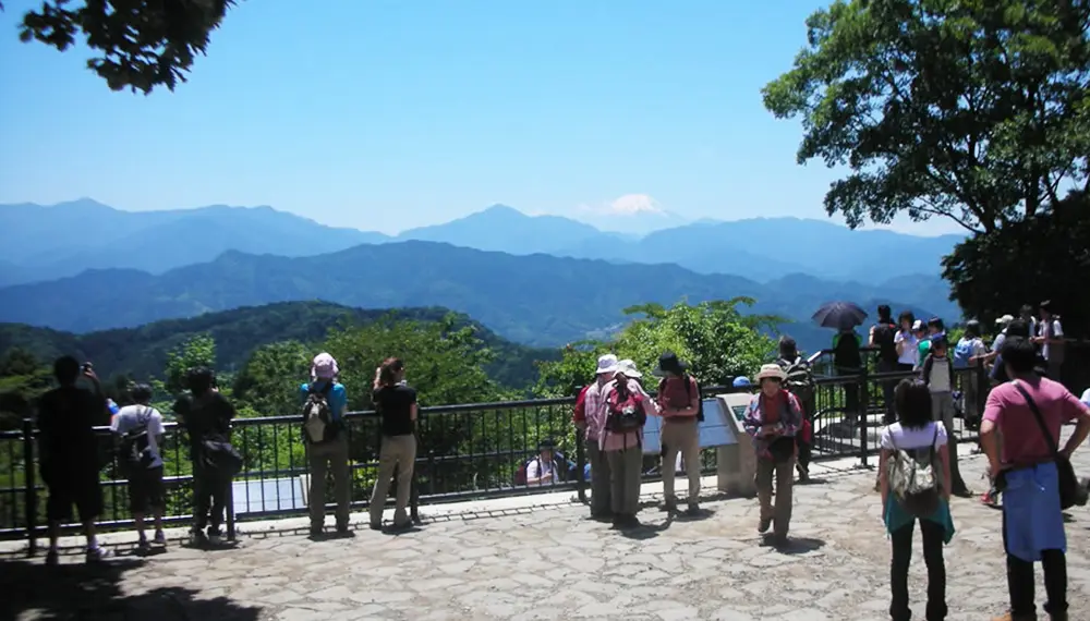
Mt. Fuji Seen from Mt. Takao
Mt. Mito
Mt. Mito is located in a quiet part of the Okutama area in Western Tokyo. It's a great place for beginner and intermediate hikers to escape the Tokyo crowds. Along the path to the summit, you will pass Mito Waterfall. Mt. Mito is also a mountain with a rare virgin beech forest in Tokyo, and Mt. Fuji can be seen from the summit on clear days. A round trip via the waterfall takes three to four hours. Be sure to bring plenty of food and water as well, as there are very few shops near the mountain. The main trailhead, Hinohara Tokyo Citizens' Forest, is about 75 minutes by bus from Musashi-itsukaichi Station. Buses to the forest are infrequent and run from spring to late autumn, except when the forest is closed, usually Mondays.
More information: Mt. Mito
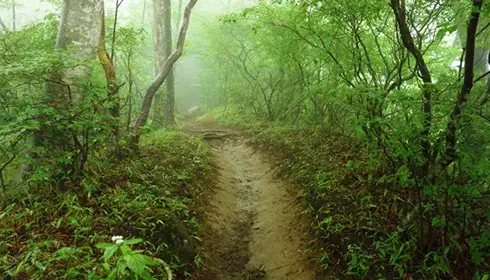 Mt. Mito Hiking Trail Surrounded by Trees
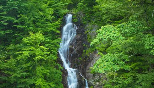 Mito Waterfall Surrounded by Lush Nature
Mt. Hinode
Hinode loosely translates as sunrise in English. True to its name, the east-facing summit is known for the first sunrise of the new year, but its wide views over the Kanto Plain are best enjoyed on a daytime hike. The trailhead is within walking distance from Musashi-itsukaichi Station. However, it can be a bit difficult to find. The tourist information center in front of the station can help with directions.
As you hike the mountain from Musashi-itsukaichi, you will come across Kotohirajinja Shrine with scenic views overlooking Akiruno City. From there, follow the trail along Konpira Ridge before arriving at the summit of Mt. Hinode. The walk from the station to the summit takes about four hours. A popular trail links the summit with Mt. Mitake, about an hour away on foot, so you can hike both in one day.
More information: Mt. Hinode
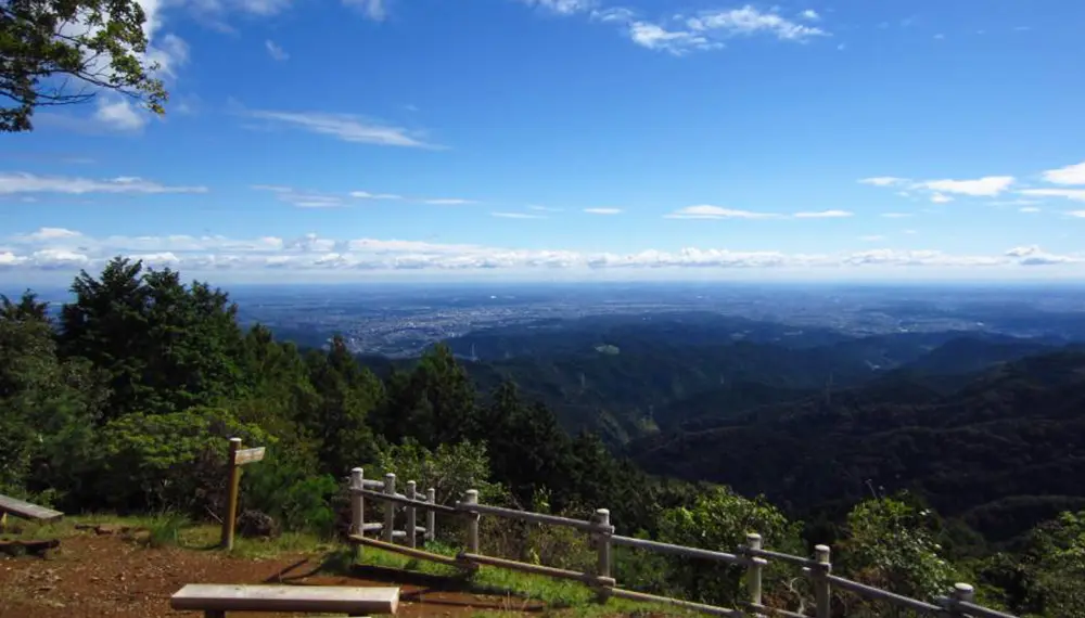
Spectacular Views from Mt. Hinode
Mt. Mitake
This stunning mountain is located in the Chichibu Tama Kai National Park west of central Tokyo. Sitting on the summit of the mountain is Musashi Mitake Shrine, a 20 to 30-minute walk from the top of Mitake Cablecar. On your way to the summit, you will pass through a village of more than 20 shukubo, pilgrim lodgings, some run by priests of the shrine. From the shrine you will have access to several hiking trails leading to neighboring peaks and valleys. Among the most beautiful destinations is a trail that takes you through a forested valley with a quiet stream and moss-covered stones. This trail is known as the Rock Garden. To reach the mountain, take a bus from JR Mitake Station to the cable car, which climbs to Mitakesan Station in about six minutes.
More information: Mitake Visitor Center
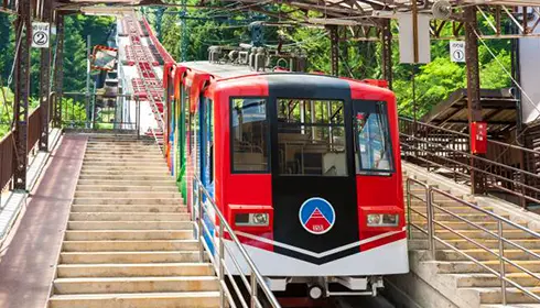 Convenient Cable Car Access
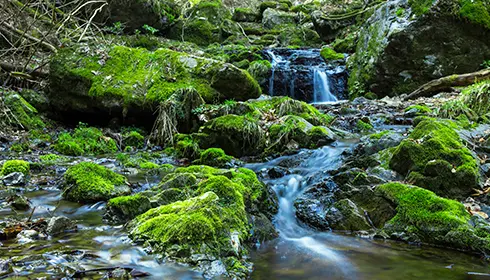 Rock Garden


Copyright © Tokyo Convention & Visitors Bureau. All rights reserved.